QLD 7265-3 For Discount
- Estimated Delivery : Up to 4 business days
- Free Shipping & Returns : On all orders over $200
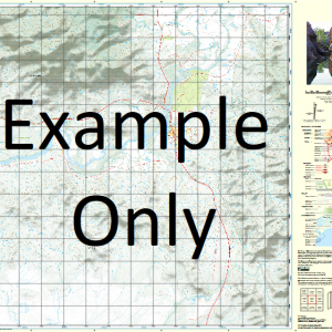
This Topographic Map is produced by the Department of Natural Resources and Mines (DNRM), part of the Queensland Government.
This product is continously updated with the latest information available. New editions are generally published in Oct Nov each year, however minor updates are constantly being included.
DNRM maps are produced automatically by computers, with minimal human oversight; so some duplication of information and occasional minor cartographic inconsistencies can be found.
The PDF version of this can be printed at home or sent to a professional printer for a 100% scale reproduction.
At this scale, 2cm on this map represents 1km on the ground. A standard map (which is square) covers an area of approximately about 25km by 25km, with a contour interval of 10m. This map contains natural and constructed features including road and rail infrastructure, vegetation, hydrography, contours, localities and some administrative boundaries.
Bayswater Waterhole Boomerang Waterhole Camp Creek Colts Lagoon Crooked Creek Doughboy Waterhole Duckhole Waterhole Firestick Creek Firestick Lagoon Galbraith Greens Hole Gumhole Waterhole Lily Hole O Reillys Hole Paddy Paddy Creek Pandanus Waterhole Piccaninny Waterhole Picnic Creek Picnic Outside Waterholes Picnic Waterhole Picnic Yard Robinson Creek Round Hole Sandy Creek Shady Waterhole Staaten Starlight Waterhole Stockyard Waterhole Timber Swamp Two Mile Creek Walkers Swamp Wyaaba Creek Yagoonya Gum Hole Duck Hole Creek Lake Condor OReillys Hole Geddes Creek Duck Hole Picnic Waterholes
| Title | Paper, Laminated, Pdf Download |
|---|
Related products
-
QLD 7056-42 Online
$12.50 -
QLD 7057-42 Sale
$12.50 -
QLD 7057-11 Online Sale
$12.50 -
QLD 7057-33 For Discount
$12.50 -
QLD 7057-14 Discount
$12.50