QLD 7057 Online Hot Sale
- Estimated Delivery : Up to 4 business days
- Free Shipping & Returns : On all orders over $200
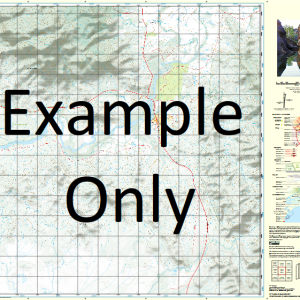
This Topographic Map is produced by the Department of Natural Resources and Mines (DNRM), part of the Queensland Government.
This product is continously updated with the latest information available. New editions are generally published in Oct Nov each year, however minor updates are constantly being included.
DNRM maps are produced automatically by computers, with minimal human oversight; so some duplication of information and occasional minor cartographic inconsistencies can be found.
The PDF version of this can be printed at home or sent to a professional printer for a 100% scale reproduction.
At this scale, 1cm on this map represents 1km on the ground. A standard map (which is square) covers an area of approximately 54km by 54km, with a contour interval of 20m. This map contains natural and constructed features including road and rail infrastructure, vegetation, hydrography, contours, localities and some administrative boundaries.
Fort Constantine Byrimine Cubbaroo Clonagh Ballaghmore Zingari Alcazabar Bendigo Park Bendigo Water Facility Blue Bush Waterhole Campian Constantine Corner Creek Cotswold Cubbaroo Water Facility Donaldson Waterhole Dry Creek Emu Waterhole Mount Fort Constantine Gipsy Creek Harry Creek Ixion Jackys Creek Mount Margaret Popanilla Sheepyard Waterhole Tommy Creek Woolshed Waterhole Yadthor Yadthor Waterhole Bowra Bore Blue Bush Bore Hudsons Tank Sancho Bore Teatree Well Cattle Creek Gidya Bore Donaldsons Well Corner Creek Bore Korong Lonagh Homestead Llaghmore Downs Cattle Creek Well Smith Creek Bore Gipsy Plains Boundary Bore Tynddol Twenty Mile Well Gloucester Sawpit Well Rosie Bore Iona Bore Gipsy Creek Bore Bloodwood Bore Dingo Hut Bore Lower Tommy Well Eliza Bore Eight Mile Well Eliza Creek Bore Whitewood Bore Middle Tommy Well Brumby Bore Three Mile Well Margaret Creek Bore Fort Constantine Homestead Bore Fort Constantine Homestead Well Fort Paddock Bore Prickly Bush Bore
| Title | Paper, Laminated, Pdf Download |
|---|
Related products
-
QLD 7057-12 Sale
$12.50 -
QLD 7056-23 Online Sale
$12.50 -
QLD 7057-14 Discount
$12.50 -
QLD 7057-23 Online now
$12.50 -
QLD 7057-13 Online Hot Sale
$12.50